Punjab govt rolls out VB-G RAM G to strengthen rural employment guarantee
The Minister said that while MGNREGA remained operational till June 30, 2026, the VB G RAM G scheme came into effect from July 1.
This is for the first time in the world that such a hi-tech technology is used to integrate a wide variety of thematic layers, multi-temporal high resolution earth observation data to analyse performance and position of previous work assets completed under various schemes and evaluate it through appropriate state authorities.

(Image: Facebook/@MGNREGAWB)
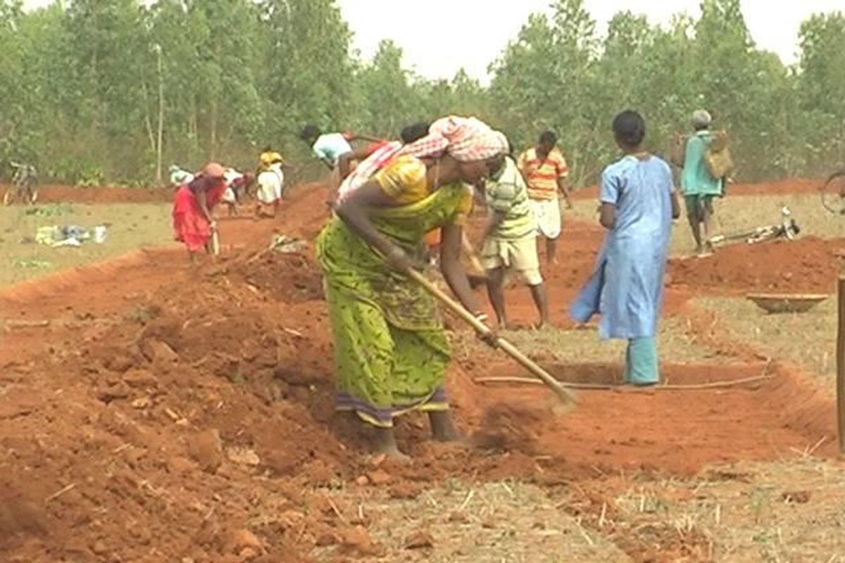
India is now going to take help from ISRO satellites to monitor MGNREGA works to evaluate and analyze the work done at ground zero to keep a check on the performance of grass root functionaries and assets created under MNREGA–a rural employment guarantee scheme aimed at helping people in Rural India.
MNREGA (Mahatma Gandhi Rural Employment Guarantee scheme)-is world’s largest employment guarantee scheme which generates more than one crore employment in a day at over 10 lakh rural work sites in various parts of the country. Since its inception it has given employment of 3620.87 crore mandays, spending Rs 7,50,878.79 crore.
Advertisement
This is for the first time in the world that such a hi-tech technology is used to integrate a wide variety of thematic layers, multi-temporal high resolution earth observation data to analyse performance and position of previous work assets completed under various schemes and evaluate it through appropriate state authorities.
Advertisement
It would not only give the actual position of work done under MGNREGA in rural areas, but would also help in ensuring quality of plan and a long term monitoring of the assets created over the years under the scheme, said a senior officer of the Department of Space here on Thursday.
“The synergy of Geographic Information and Earth Observation technology has not only brought the value of location to each rural asset, but also brought in unprecedented transparency in MGNREGA programme,” admitted a senior officer of the Rural Ministry, which is working in close coordination with ISRO to implement this project.
The Ministry has prepared a new portal Bhuvan ‘Yuktdhara’ that would facilitate planning of new MGNREGA works using Remote Sensing and GIS based information. “This platform will serve as a repository of assets (Geotags) created under various national rural development programmes i.e. MGNREGA, Integrated Watershed Management Programme, Per Drop More Crop and Rashtriya Krishi Vikas Yojana etc., along with field photographs,” said Minister of State Jitender Singh while launching the new portal.
The portal was created in close coordination with the ISRO (Indian Space Research Organisation) and the Rural Ministry. The Union Minister of Rural Development Giriraj Singh said that because of its rich information base, satellite images and analytical capabilities, Bhuvan, in fact, has become a de-facto geospatial platform for a number of developmental planning activities in the country.
The portal integrates a wide variety of thematic layers, multi-temporal high resolution earth observation data with analysis tools. Planners would analyse previous assets under various schemes and facilitate identification of new works using online tools. Plans prepared will be evaluated by appropriate authorities under State Departments.
“Thus, Yuktdhara based plans will be prepared by grassroot functionary and verified by appropriate authorities for relevance and resource allocation. This would ensure quality of plan and enable a long term monitoring of the assets created over the years,” Rural Minister said.
The initial assessment of integration of Before-During-After Geotagging of assets created under MGNREGA has shown very encouraging results. It has successfully implemented the progress based disbursement of the funds during the process of creation of rural assets.
Advertisement