WBCERC fines diagnostic clinic Rs 3L for negligence in colonoscopy
The WBCERC has directed the management of the clinic to pay the money to the patient as compensation in eight installments.
According to Joint Typhoon Warning Center, the cyclone’s wind speeds were equivalent to a Category 4 hurricane.
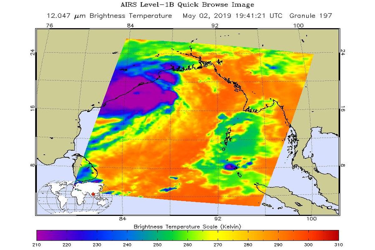
NASA's AIRS image of Cyclone Fani before landfall (Photo: nasa.gov)
A day before the ‘extremely severe’ Cyclone Fani made its landfall on the Odisha coast, the NASA on Thursday captured the image of the cyclonic storm just off the east coast of India in the Bay of Bengal.
According to Joint Typhoon Warning Center, the cyclone’s wind speeds were equivalent to a Category 4 hurricane, with maximum sustained winds of 155 mph (249 kph) and gusting up to 190 mph (306 kph), when the image was collected.
“AIRS, in conjunction with the Advanced Microwave Sounding Unit (AMSU), senses emitted infrared and microwave radiation from Earth to provide a 3D look at weather and climate,” NASA said in a statement.
Advertisement
The infrared image shows temperatures of the clouds or surface. The large purple area indicates very cold clouds carried high into the atmosphere by deep thunderstorms. Warmer areas, including the eye of the cyclone, are shown in blue. Shallower rain clouds appear green, while the orange areas represent mostly cloud-free air moving away from the storm, NASA said.
The impact of the landfall began on Friday morning with heavy rains and strong winds lashing Odisha and parts of Andhra Pradesh. A wind speed of 145 km per hour has been recorded, according to IMD.
The Odisha government had targeted to evacuate 11.50 lakh people from low lying areas along 11 coastal districts by Thursday evening.
Advertisement