China has occupied a village of Nepal and allegedly removed the boundary pillars to legitimise its annexation, top government sources said on Tuesday. It has also been learnt that China has gradually made inroads into several Nepalese territories with an ulterior aim to seize complete control.
The latest in the line is Rui village in Gorkha district, which is now in total control of China. “In a massive departure from its diplomatic stand of non-interference, the Chinese have completely occupied Rui Village and the residents comprising around 72 houses are fighting for their original identity. This also shows how Nepal’s current regime has surrendered to China and is now making anti-India statements and resorting to anti-India activities,” top sources told IANS.
Advertisement
Apart from Rui village, China has also occupied strategic lands at 11 places across Nepal. Around 36 hectares of land in four districts of Nepal, which border China, have been illegally occupied by China, but so far Nepalese government is tight-lipped about it. The occupation of Rui village has been done systematically by China in the last two years.
Since the village figures in the map of Nepal and is part of the Himalayan nation, the residents have always been associated with the country’s identity. But the Nepal government, at the behest of China, is more engaged in creating artificial disputes with India over boundaries and three villages that belong to India.
Meanwhile, the relation between India and Nepal has turned sour after Nepal’s national assembly on Thursday passed the controversial bill on its updated political administrative map which includes parts of Indian territory, escalating the border dispute.
The New Map Amendment Bill (Coat of Arms) refers to an updated map which shows strategically important Indian territories of Kalapani, Lipulekh and Limpiyadhura as territories of Nepal.
On June 13, the parliament of Nepal voted in favour of the constitutional amendment bill in a special session to update the country’s map, claiming areas under Indian territory.
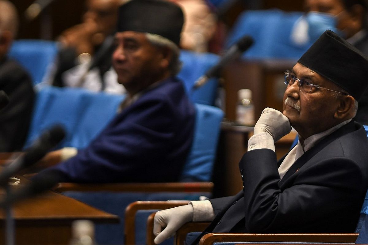
Prime Minister KP Sharma Oli’s party had cleared the map last month which ignited fierce criticism from India which termed it as a unilateral move on a ‘sensitive issue’.
The new political map was authenticated by Nepal President Bidya Devi Bhandari last week. Delhi-Kathmandu relationship came under strain after Defence Minister Rajnath Singh inaugurated an 80-km-long strategically crucial road connecting the Lipulekh pass with Dharchula in Uttarakhand on May 8. Nepal immediately protested, saying the road violated the status quo of the region, which it described as “unresolved”.
Spokesperson of the Ministry of External Affairs Anurag Srivastava had said the amendment amounts to “artificial enlargement of claims that are not based on historical fact or evidence and is not tenable”. Last year, sources said, Nepal government realised China had been annexing their land however they preferred to remain silent.
“Even after realizing that China’s aggressive nationalism and military expansionism are a reality, the policies fashioned by hardline Communist Party of China (CPC) leaders, Nepal communist government prefers to remain silent,” said the sources. The KP Oli government has found that China has already occupied six hectares of land near Bhagdare Khola (River) area and four hectares near Karnali River in Humla district.
They also found that China has illegally occupied two hectares near Sinjen Khola (river) and one hectare of Bhurjuk Khola (River) in Rasuwa district. It has also captured land adjacent to Lamde Khola and three hectares near Jambu Khola in Rasuwa district. China has also illegally occupied seven hectares of land in Kharane Khola and four hectares near Bhote Koshi of Sandhu Pal Chok district in Nepal, three hectares of Samjung Khola, two hectares near Kam Khola and four hectares of land from Arun river bed in Sankhuwasabha district of Nepal.
The term khola means river in local Nepali language. But, instead of objecting to Chinese illegal occupation and growing infiltration into the Nepalese boundaries, the KP Sharma Oli government is looking to unnecessarily interfere in India’s sovereignty. Besides the new map, Kathmandu has stopped repair work for Gandak dam in Lal Bakeya river in Bihar on border with India by erecting barriers at several locations. The Gandak barrage has 36 gates of which 18 are in Nepal and the neighbouring country has put barriers in the area where the flood-fighting material is present, threatening flooding in Bihar during monsoon.
This provocative move, sources said, is being done by Kathmandu at China’s behest which has crippled the world by spreading contagious coronavirus and is aggressively pursuing its expansionist policy.
“Nepal’s domestic policy appears to be ruled by China. The Oli government is escalating the tension between the two countries on issues that have earlier never figured in India-Nepal bilateral relationship. Occupation of its villages by China and now Nepal’s provocative gesture in Bihar that shares 700 km international border with Nepal, makes it evident that Oli government is being ruled by Beijing,” top sources said.