After more than 70 years, India and Pakistan have waged intermittent and deadly conflict over control of the mountainous region of Kashmir. Tens of thousands have died in the conflict, including three just this month.
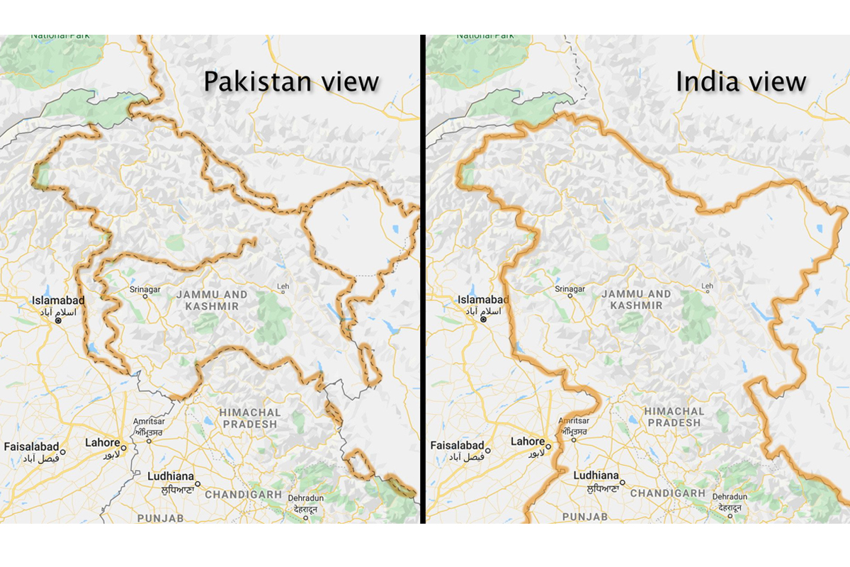
Both sides claim the Himalayan region as their own. But that is not the case for web surfers. Google Maps shows Kashmir as part of India as long as you view it from within the borders of the country, but for people outside the country, the outlines of the region are shown in dotted lines, suggesting it to be “disputed” territory, The Washington Post reported.
Advertisement
Google’s corporate mission is “to organize the world’s information,” but it also bends it to its will. From Argentina to the United Kingdom to Iran, the world’s borders look different depending on where you’re viewing them from, said the report on Friday.
This is because Google, as well as other online map makers, change them.
According to Google, it follows local legislation wherever local versions of Google Maps are available. “Our goal is always to provide the most comprehensive and accurate map possible based on ground truth,” Ethan Russell, Director of Product Management for Google Maps, was quoted as saying in a statement by Post.
“We remain neutral on issues of disputed regions and borders and make every effort to objectively display the dispute in our maps using a dashed gray border line. In countries where we have local versions of Google Maps, we follow local legislation when displaying names and borders,” Russell added.
However, Google’s map-making also gets influence by “the shifting whims of diplomats, policymakers and its own executives”, said the report, citing people familiar with the matter.
Started 15 years ago, more than 1 billion people now turn to Google Maps to see and explore the world. Google Maps has mapped more than 220 countries and surfaced information for about 200 million places and businesses.
Besides using satellite imagery, Google Maps also makes use of contributions made by volunteers and advanced technologies such as Artificial Intelligence and Machine Learning for its map-making activities.
While Google dominates the mobile maps market, Apple Maps comes second in terms of popularity. An Apple spokeswoman told The Washington Post that the iPhone maker is responsive to local laws with respect to border and place name labelling.
(With input from agencies)