Apple Maps adds cycling directions for users in US cities
This is a continuation of the rollout of biking paths within Apple Maps. On April 1, 2022, Apple added them to the Northeastern US.
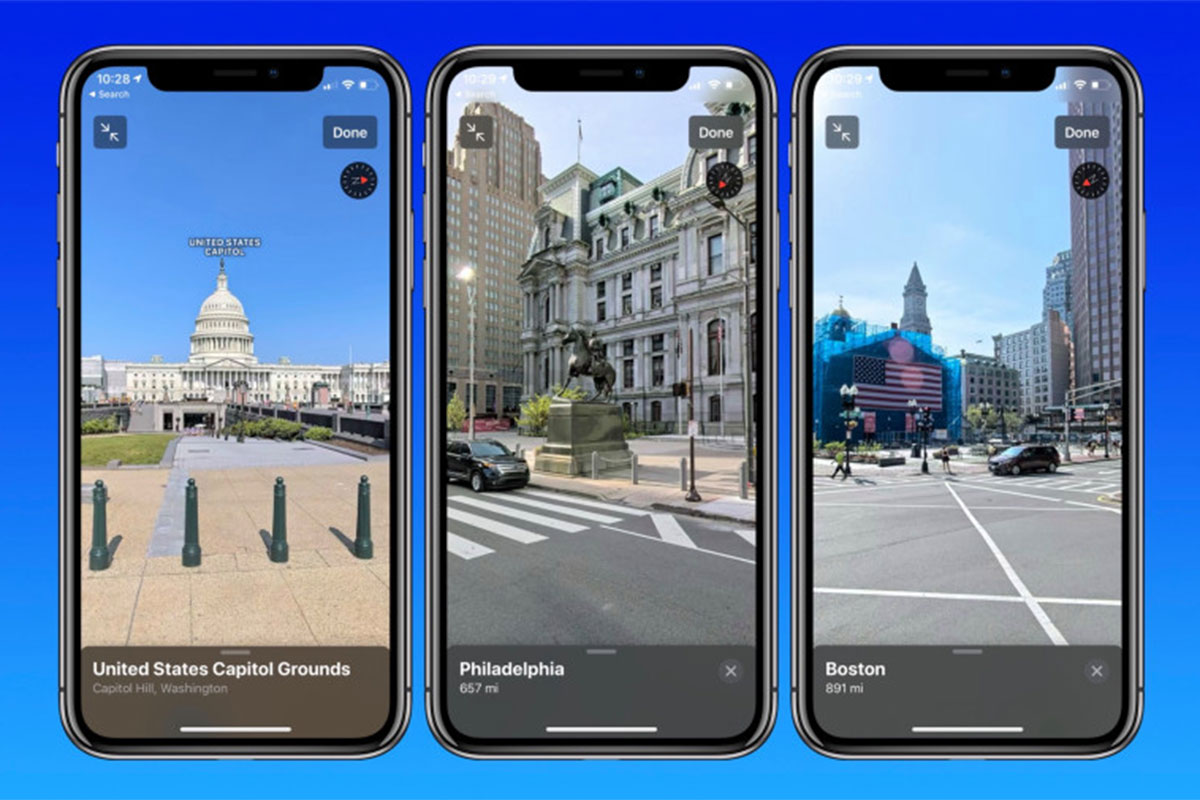
The feature works relatively similar to Google Street View, wherein the view can be changed by swiping the display.

The new Apple Maps design gives users improved navigation, better road coverage, and much more. (Photo: 9to5Mac)
One of the biggest changes in Apple maps after its redesign earlier this year is a new feature called ‘Look Around’. The feature has now expanded to Chicago, adding another area to the 3D imagery that is similar to Googles Street View.
The new Apple Maps design gives users improved navigation, better road coverage, and much more.
Advertisement
“Maps offers interactive street-level imagery with high-resolution, 3D photography and smooth and seamless transitions through major cities with Look Around. Explore select cities with an interactive 3D experience that gives you a 360‑degree view of a place. And enjoy smooth and seamless transitions as you navigate your way around,” reads Apple description of the feature.
Advertisement
The Apple Maps Look Around is supported by any device that runs iOS 13 or iPadOS 13, or any Mac that can run macOS 10.15 Catalina.
The feature currently is available in the San Francisco Bay Area, Los Angeles, New York City, Las Vegas, Houston, the Hawaiian island of Oahu, Boston, Philadelphia and the Washington DC area.
In areas where ‘Look Around’ is available, a binoculars icon will appear in the top-right corner of Apple Maps. Tapping that icon opens a street-level view in a card overlay at the top of the screen, which can then be expanded to a full-screen view, reports MacRumors.
The feature works relatively similar to Google Street View, wherein the view can be changed by swiping the display while tapping part of the road in the distance will move the camera to that point.
Instead of relying on third-party mapping services for its information, Apple has had its fleet of vans hit the road sporting cameras and sensors to develop its own in-house maps.
Advertisement