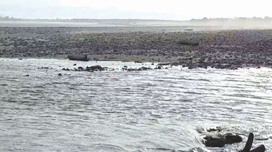
The otherwise placid frontier state of Arunachal Pradesh suddenly shot into national news last month as the pristine waters of its river Siang had mysteriously turned black near Pasighat town from the presence of ‘cement-like thick materials’ coming from Chinese territories through which the river flows after originating in the Jima Yangzong glacier near Mount Kailash in Tibet. Fingers were therefore pointed at China which is accused of constructing tunnels to divert the river’s waters to its parched Taklamakan desert areas in the restive northern province of Xinjiang.
There were also reports that a 6.4-magnitude earthquake on November 17 had triggered massive landslides in this geologically active region, about 400 kms from Pasighat, and the resulting debris carried by the river was responsible for the darkening of its waters. The contamination led to massive loss of aquatic lives, and preliminary laboratory reports confirmed the presence of heavy slag and turbidity whose count rose to 425 Nephelometric Turbidity Units against the normal range of 12-15, rendering the waters unsafe for all life. Siang is part of Asia’s most important trans-boundary river system feeding China, India and Bangladesh.
Advertisement
The 2,880 km-long river flows 1,600 kms through southern Tibet as Yarlung Tsangpo before entering Arunachal Pradesh at the ‘Great Bend’ as Siang, then flows downstream into Assam as Brahmaputra before entering Bangladesh as Padma to finally merge into the Bay of Bengal. It is the life-blood of India’s Northeast and Bangladesh. As such, given China’s economic and military ambitions in the region, such phenomenon cannot just be ignored simply as ‘natural occurrence’. It has once again exposed the vulnerability of Arunachal Pradesh, which has been a victim of the ‘China factor’ on territorial issues since colonial times, adding a new threat to this ecologically sensitive region.
China’s spectacular economic expansion over the past two decades extensively depleted not only its own natural resources but also those of its neighbours like Myanmar. This has created intense pressure on the supply side to meet the ever-rising demand of the Chinese economy including energy and natural resources, and forced China to reframe its strategy of building surplus reserves from every possible source. As pointed out by security expert Wasbir Hussain, a UN report shows that by 2030, China’s water demand will surpass 800 billion cubic metres, while currently it possesses only seven per cent of the world’s freshwater supplies serving 21 per cent of the world’s population. China is now termed as a ‘water-poor’ nation.
To meet its huge demand-supply gap, China is conspicuously moving beyond its territorial boundaries, exploiting river basins across its neighbourhood. Arunachal Pradesh with its vast water resources is a natural target of this strategy. River Siang alone is estimated to have water energy reserves amounting to 68 million kilowatts. A feasibility study made by Chinese scientists in 2003 of its mega hydropower Zangmu dam project had identified the potential to divert 200 billion cubic meters of water annually to China from this river system, which will have extremely worrisome consequences for downstream riparian countries like India and Bangladesh. The dam was constructed and operationalised in 2015, and the first generating unit of the $1.5 billion plant located 3,300 metres above sea level has a capacity to generate 38,000 megawatts of power – twice that of China’s Three Gorges Dam. At least four more dams in the same area are under various stages of construction near the ‘Great Bend’ to divert water of this river system, to China’s arid northern areas to augment their agricultural and industrial growth.
This monstrous economic agenda of China is bound to create serious imbalances and ecological degradation all over. According to its own 2013 report, during the past two decades, China has lost more than 28,000 of its rivers. Besides, China’s wetlands have shrunk by nearly nine per cent to make way for massive infrastructure projects since 2003.These multipurpose projects are capable of regulating and diverting the flow of any river and degrading the water quality like the blackening of Siang river at Pasighat Valley.
Energy policy expert Ryan Hodum had pointed out in 2007 that construction of dams on this trans-boundary river system, though highly beneficial for China, would be devastating for India’s Northeast and Bangladesh. These dams can drastically reduce the total water flow in these regions by as much as 60 per cent, besides inflicting serious ecological damage affecting 1.3 billion people, or 20 per cent of the world’s population who inhabit the river basins in China, India and Bangladesh. These three countries which share this river waters are also the world’s first, second, and seventh most populous countries, all of which are facing severe problems from water scarcity and rising demand for power generation. Over the next two decades, the annual per capita water availability in the basin will decline by 13 to 35 per cent, making water even more scarce which may lead to heightened anxiety and disputes between these countries, if not a ‘war over water’.
The Siang Valley of Arunachal Pradesh is also inhabited by two prominent indigenous communities, Adi and Galo, who live across 23 villages on the banks of the river. The Siang basin with about 80 per cent forest cover having 1,349 plant species and 1,197 animal and fish species provides their livelihood. But its immense hydropower potential has already exposed the valley to dam construction activities even by the India, which would certainly result in inundation of their traditional rice fields and disturb ecological balance. Thus not only Chinese designs, but Indian strategy also militate against the interests and rights of the indigenous people, and have provoked several anti-dam movements in the region.
The situation therefore demands urgent policy initiatives both at domestic and international levels. Besides bilateral engagements between China and India, sub-regional cooperation within the existing BCIM framework can be utilised to frame a comprehensive energy strategy including sharing of resources and information for sustainable growth and inclusive development of the region. India has concerns over China not sharing hydrological data on the flow of the Siang through Chinese territory. A Memorandum of Understanding was signed between India and China in 2002 to co-ordinate data-sharing pertaining to water levels, water discharge, rainfall and diversion of river water. In 2006, both governments agreed to establish an expert-level institutional mechanism to discuss trans-boundary river issues, but the results have not so far been encouraging.
China’s dire water scarcity combined with its uniquely advantageous upper riparian position have given it the opportunity to exploit and divert the flow of water, the consequences of which are directly affecting India’s Northeast, making China a ‘hydro-hegemon’ in the region. Given the undercurrent of contemporary India-China relations, one cannot expect any meaningful cooperation towards developing a joint strategy anytime soon. Rather disputes over water resources have potential to trigger conflicts and tensions. All the three affected nations therefore need to put serious efforts to frame an alternative sustainable energy strategy to protect both the fragile ecology and traditional livelihood of this entire region.