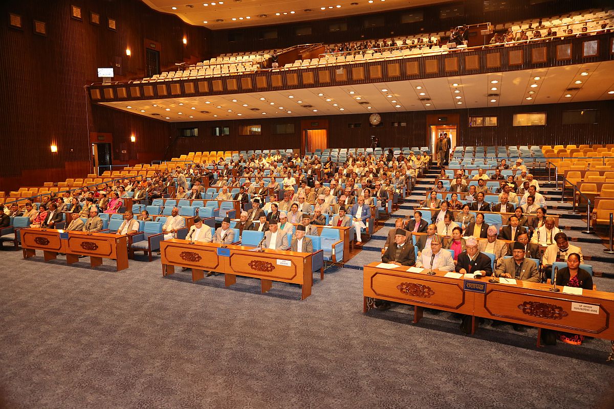
Anew map of Nepal with a new national emblem flutters before the comity of nations today in the immediate aftermath of the unanimous passage of a constitutional amendment by the country’s House of Representatives, pre-eminently the inclusion of the three disputed territories of Limpiyadhura, Lipulekh and Kalapani.
The Himalayan country has thus rather unilaterally extended its frontiers, and Saturday’s development might well be rated by historians as a remarkable expression of cartographical aggression, if ever there was one. Viewed through the prism of international boundaries, there is little doubt that it represents what the MEA in Delhi calls “an artificial enlargement of claims”.
Advertisement
India is justifiably distressed that the legislative intervention has been accorded the short shrift to negotiations to resolve prickly boundary issues, indeed a critical facet of geostrategy. India’s equation with Nepal is in crisis, fair and square. The distressing development has happened in parallel to the Sino-Indian kerfuffle in Ladakh.
The striking irony must be that three Nepalese cadets were commissioned at the Indian Military Academy in Dehra Dun on Saturday, coinciding with Kathmandu’s posturing on the border. More basically, the contours of the revised map, are intended to serve the narrow ends of Prime Minister KP Oli, who has been contending with the country’s Opposition on a welter of issues.
Though he has played to the nationalist gallery, the objective is rather myopic, if not dodgy. Last Wednesday, 72 hours before the constitutional amendment, the government in Kathmandu had formed a nine-member team of experts to collect historical data related to Nepal’s suzerainty over Kalapani and Susta.
Ergo, it is hard not to wonder if the Nepalese themselves will readily concur with what has turned out to be an almost unilateral expansion of territory to suit the incumbent Prime Minister’s political agenda. One could argue that the issue was overshadowed by the frightful surge in coronavirus afflictions and deaths in India.
Furthermore, Nepal could have waited for a while before engaging in this politically-driven exercise in map-pointing. The impression that it has thus conveyed to the world in the wider canvas is that it was in a hurry, as tearing as it was inexplicable.
It bears recall that in 2014, both sides had mandated the two Foreign Secretaries to work on the issues of Kalapani and Narsahi- Susta and with technical inputs from the Boundary Working Group, as and when required. Indeed, Delhi had agreed to talks on Kalapani after Nepal had objected to the inauguration of the Kailash- Mansarovar road by India on 8 May.
On closer reflection, that inauguration has powered the redrawing of the map and the resultant souring of relations between two member-nations of Saarc. Given the context, the Army chief, General Naravane’s stress on Saturday on “close and civilisational ties” runs counter to ground reality and literally so.