Uttarakhand govt asks universities to focus on obtaining higher NIRF rankings
The Uttarakhand government wants to focus on improving the national rankings of the state's universities and educational institutions.
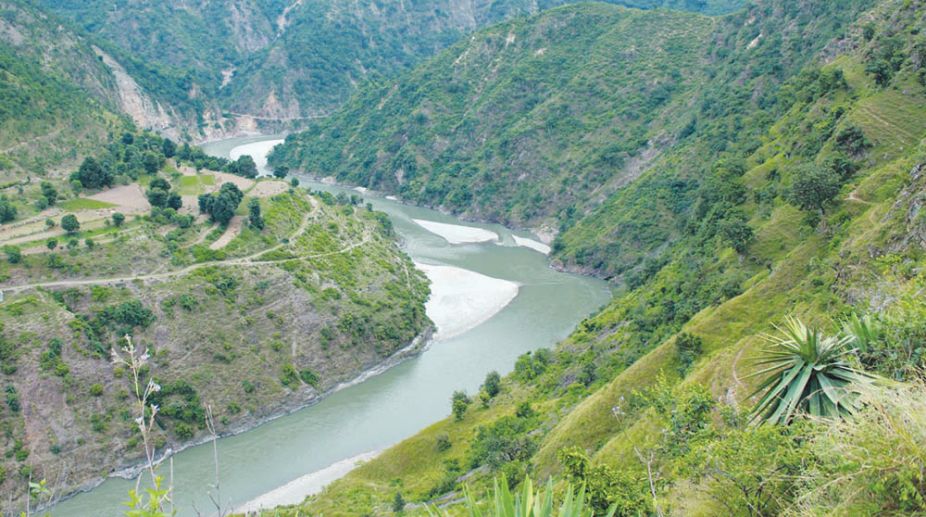
The submergence area of proposed 660 MW Kishau dam on the border of Himachal Pradesh and Uttrakhand will spread over…

Kishau dam project
The submergence area of proposed 660 MW Kishau dam on the border of Himachal Pradesh and Uttrakhand will spread over 2,950 hectares in the two hill states.
Of the total submergence area, 512 hectares is cultivated private land and 2,438 hectare is forest land, as per information received under Right to Information Act from UJVNL. Sharing the information, Manshi Asher from Himdhara Collective said in 2014-15, Prakash Bhandari and Kesang Thakur from the organisation had done field investigation on the impact and had come out with a report ‘Submerging Jaunsar Bawar’.
Advertisement
As per details, nine villages of Uttarakhand and eight villages (six from Sirmour and two from Shimla district) will be affected by the project.
Advertisement
Kishau dam project, being executed in joint venture by two states, would utilise the water of river Tons which is a major tributary of river Yamuna and forms boundary between HP and Uttarakhand in most of its reaches in this region.
The water stored in the Kishau reservoir shall be utilised for irrigation, power generation and to augment drinking water supply for national capital Delhi.
Asher said a total of 5,498 people belonging 701 families will be directly affected by the project. The forest based livelihood and food system will be completely destroyed as more than 15 lakh trees will face the axe because of this project.
She said the project involves building of a 236 m high dam on river Tons, which is a major tributary of the Yamuna, originating in the Jamnotri mountains and passing through Shimla and Sirmour districts and Jaunsar Bawar region in district Dehradun.
Except in some parts, where it flows through the small town of Tiuni and a little beyond, the river forms boundary of the states of Uttarakhand and HP.
The submergence area on the left bank is part of the Jaunsar Bawar region of Chakrauta tehsil, Dehradun district which is a Schedule-V area.
All along 44.5 kms of the submergence area, villages are located on both sides of the river at some interval, which have strong religious, cultural and economic ties.
Agriculture with livestock rearing is the main livelihood activity in the region.
“If we look at the cost-benefit analysis only from the point of view of the state of HP, the ratio seems quite poor. Himachal will get no share in the irrigation, only 50 per cent in the power and will lose 177 hectares of cultivated land, 1,321 hectares of forest land and will displace hundreds of families in return,” she said.
The Himdhara Collective held that the priority of the HP government remains distorted – with the focus on earning higher revenues instead of looking at the concerns of its own people and environment.
Advertisement