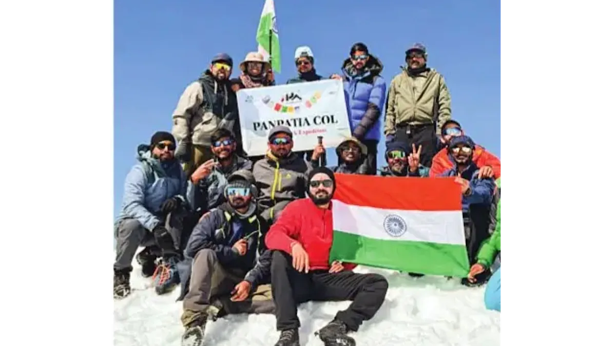
Long before modern roads connected Kedarnath and Badrinath, a high mountain route was believed to link the two shrines. This route is now associated with Panpatia Col. It crosses glaciers, icefields, and some of the most difficult terrain in the Indian Himalaya. Today, most of it no longer exists as a clear path. Ice and time have erased it. The expedition started on 3 June and ended on 11 June.
The crossing of Panpatia Col was completed on 9 June. The idea came from a mythological story. It is said that a priest once performed rituals at both Kedarnath and Badrinath in a single day. This story stayed in the mind for years. Satyaki Chatterjee said, “The main inspiration was the mythological route connecting Kedar and Badri. When I later saw the geography, it felt almost impossible.” The two temples lie in different valleys of Uttarakhand. High mountains and glaciers separate them. The real terrain made the myth even more interesting. This gap between belief and geography became the reason for the expedition.
Advertisement
The goal was to cross the Panpatia Icefield and trace the high route between the two shrines. The team also planned to camp near the base of Chaukhamba. Preparations took several years. The team completed many high-altitude treks above 5000 metres. These included Everest Base Camp, the Annapurna Circuit, and Tsergo Ri. Physical training was strict. It included daily 5 km running. It also included stair climbing around 60 times to the second floor. The team trained with 12-15 kg backpacks. Mental preparation was equally important.
At high altitude, conditions change without warning. Decisions must be calm and practical at the same time. Satyaki explained that anyone trying this kind of expedition must throw away the word fear from the brain and move forward. The early part of the trek involved glacier walks and a gradual ascent. As the team moved higher, the terrain became more technical and isolated. One major challenge was Parvati Gully. The slope was steep and icy. Fixed ropes were used for climbing. Every movement needed proper attention. As altitude increased, oxygen levels dropped. Progress became slow. The terrain changed into ice, rock, and narrow ridges. The most critical moment came just before the pass. On the fifth day, the team was only about 500 metres from the summit point. Then the weather changed suddenly.
Heavy snowfall began. Visibility dropped to zero. The route disappeared completely. Satyaki recalled: “Suddenly, everything turned white. Even the route was not visible anymore.” At around 5500 metres, the team stopped and built an emergency camp beside an ice wall. The night was extremely cold and uncertain. The team crossed Panpatia Col on 9 June. After the crossing, the descent through Kachni Khal began. This section was also very dangerous. The route had loose rocks and narrow traverses. The light was low. Fatigue added more risks. Satyaki said, “A single wrong step can have taken us down a long fall on treacherous rocks.” Technical guides Jayram Panwar and Mahindra Ji handled the navigation and safety decisions. Team leader Anish Dey coordinated the group and timing.
Their role was critical in keeping the expedition safe. Panpatia Col is not a clear route anymore. It has changed with time and ice. Only experienced mountaineers opt for it. Satyaki reflected: “We returned safely. It felt like the route itself allowed us to come back.” The expedition remains a journey between myth and reality. It is not only about difficulty. It is about respect for the mountains and the fragile nature of these ancient Himalayan paths.