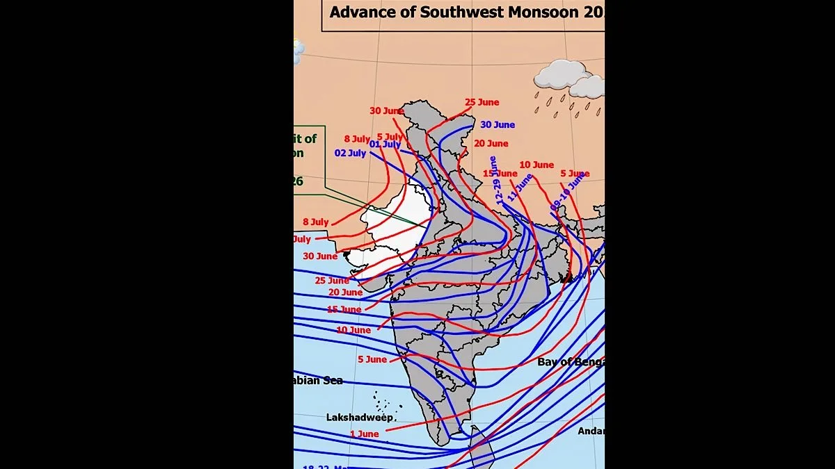
After a delay of almost a week, the southwest monsoon made rapid progress overnight to enter Rajasthan and cover areas of the southeastern region of the state up to Tonk on Thursday.
A Meteorological Office spokesman said, “The Northern Limit of Monsoon (NLM) on Thursday afternoon was passing through 22°N/60°E, 22°N/65°E, Porbandar, Vallabh Vidyanagar (Gujarat), Neemuch (MP), Tonk (Rajasthan), Bhiwani (Haryana), Bhatinda (Punjab) and 32.5°N/70°E.
Advertisement
The rapid progression of the NLM, a line of hope for the desert state, is evident from the fact that on Wednesday afternoon it was passing through Porbandar, Vallabh Vidyanagar, Shajapur, Naugaon (MP), Mirzapur, Azamgarh, Ayodhya, Budaun, Meerut (UP), Karnal(Haryana), Gurdaspur (Punjab) and extended up to 32.8°N/73°E.
However, under the effect of a low-pressure area that has formed over the northwest Bay of Bengal and adjoining north Odisha-West Bengal coast, the monsoon is expected to maintain its progress and remain active over the next four to five days.
The Weather Office said, “A low-pressure area has formed over the northwest Bay of Bengal and adjoining north Odisha-West Bengal coast. As a result, the monsoon is likely to remain in an active phase over the central parts of the country during the next five days.
Meanwhile, rainfall activity has also gained pace in the state over the past 24 hours. According to the Meteorological Centre and the Irrigation Department’s control room, around 70 rain-gauging stations reported light to moderate rainfall until Thursday morning.