Explainer: Why is India making it harder for ISRO scientists to resign?
The memorandum, issued on July 14, was signed by SR Rajashekar, Joint Secretary (Personnel), Department of Space.
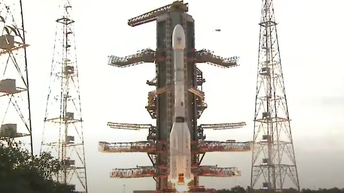
The Indian Space Research Organisation (ISRO) on Wednesday successfully launched NISAR, a first-of-its-kind earth observation satellite jointly developed with the National Aeronautics and Space Administration (NASA), from the Satish Dhawan Space Centre in Sriharikota.

(Photo: ISRO/IANS)
The Indian Space Research Organisation (ISRO) on Wednesday successfully launched NISAR, a first-of-its-kind earth observation satellite jointly developed with the National Aeronautics and Space Administration (NASA), from the Satish Dhawan Space Centre in Sriharikota.
The satellite — NASA-ISRO Synthetic Aperture Radar — lifted off at 5:40 pm aboard the GSLV-F16, India’s heavy-lift Geosynchronous Satellite Launch Vehicle.
Advertisement
A team of scientists from NASA visited the space centre on India’s southeastern coast to witness the launch. The rocket inserted the NISAR satellite into a 747 km sun-synchronous orbit, nearly 20 minutes after the initial lift-off.
Advertisement
In a post on X, ISRO announced the successful launch of the mission, stating, “Separation confirmed. Each stage, precise. Cryo ignition and Cryo stage performance flawless. GSLV-F16 delivered NISAR to orbit.”
Addressing the press here, Union Minister of Science and Technology, Jitendra Singh hailed India’s role in these game-changing technologies. “Through this biggest collaboration with NASA—an agency established long before its Indian counterpart—we are contributing as equal partners in the game-changing experiments,” he said.
Singh also pointed out that, shortly after the historic Axiom-4 mission, India has achieved another milestone in space technology—one whose benefits will extend beyond disaster response for floods, cyclones, and landslides.
Sectors such as aviation, shipping, and agriculture will also benefit from the SAR satellite, which can provide navigation data even in foggy conditions, dense cloud cover, and through multiple layers of ice in regions like Antarctica.
ISRO outlined the next stages of the mission: commissioning, calibration, and finally, the start of scientific operations.
According to the Indian Space Agency, full-scale operations of the NISAR satellite will begin after a 90-day commissioning period. Following the launch, the next phase of the mission is the deployment stage, during which an unfurlable radar reflector antenna onboard the satellite will be deployed in space within 10 days.
It took nearly a decade and over USD 1.5 billion to develop the 2,392-kg NISAR satellite, which is designed to scan the entire planet every 12 days.
For the first time, an Earth observation mission will use two different radar frequencies—L-band and S-band—to detect changes on the Earth’s surface as small as a centimeter.
The two radar systems aboard NISAR will track both large-scale and subtle changes in the Earth’s surface and climate over time. The L-band radar, developed by NASA, can detect minute shifts in land and penetrate dense vegetation. The S-band radar, built by the Indian space agency, is designed to capture broader surface features and see through cloud cover.
The mission will capture high-resolution images of Earth under all weather conditions, day and night, enabling scientists to better understand the processes behind natural hazards such as earthquakes, landslides, and volcanic eruptions.
According to NASA, the NISAR will also provide crucial data on changes in ice sheets, glaciers, and sea ice, and enhance scientific understanding of how deforestation, permafrost loss, and fires affect the carbon cycle. It will also support monitoring of infrastructure, such as dams, bridges, and roadways.
Following the successful launch, NASA said in a statement that the NISAR satellite will orbit Earth for at least three years. NASA and ISRO will jointly operate the spacecraft to gather scientific data of high priority to both the United States and India.
The data will be made available as an open-access scientific resource through the ISRO website, in line with Prime Minister Narendra Modi’s vision of Vishwa Bandhu (India as a friend to the world), the minister said.
Advertisement