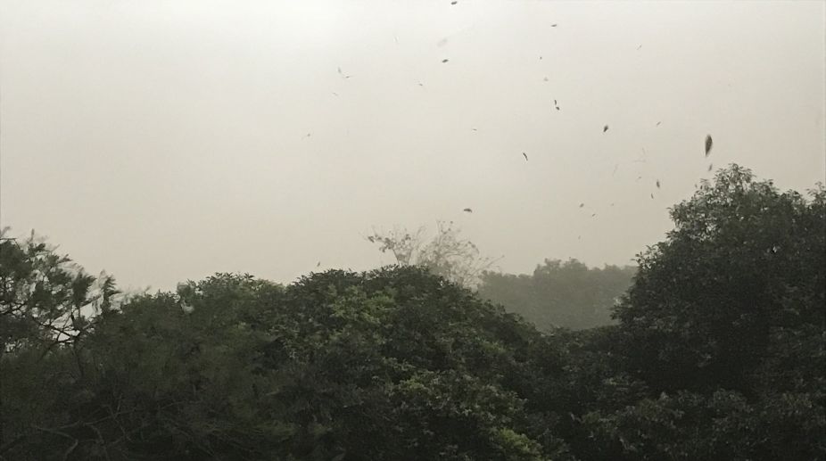
The weather forecast turned right for Delhi on Friday as the city was greeted with overcast sky in the evening, followed by a thunderstorm.
With pre-monsoon rains escaping Delhi-NCR for a long time now, the region had seen early arrival of heat. Both maximum and minimum temperatures have been settling above the normal average for many days now.
Advertisement
On Monday, the Safdarjung Observatory of Skymet Weather recorded maximum day temperature at 37.6°C, while night temperature settled at 22.5°C, both above normal by three degrees each.
According to the forecast by Skymet Weather, pre-monsoon activities are likely to finally make an appearance in the region, and it will be a prolonged spell — from April 6-10.
A Skymet Weather report said the pre-monsoon activities would mostly occur during the latter part of the day or evening.
The report said Delhi-NCR would record thunderstorm and dust storm for the next 24-48 hours, with isolated pockets also witnessing light thundershowers and the sky remaining partly cloudy to cloudy.
According to weathermen, a fresh Western Disturbance over Jammu and Kashmir has induced a cyclonic circulation over Northeast Rajasthan and adjoining Haryana. Another feeble cyclonic circulation is seen over Northwest Uttar Pradesh and adjoining areas.
Due to the combined effect of these weather systems, many parts of northwestern plains including Delhi may record thunderstorm or dust storm activities.
As per Skymet Weather, intensity of rains is likely to pick up pace by April 9 and some rain and thundershowers can be expected till April 10 on account of the passage of another Western Disturbance, which would keep the circulations activated.