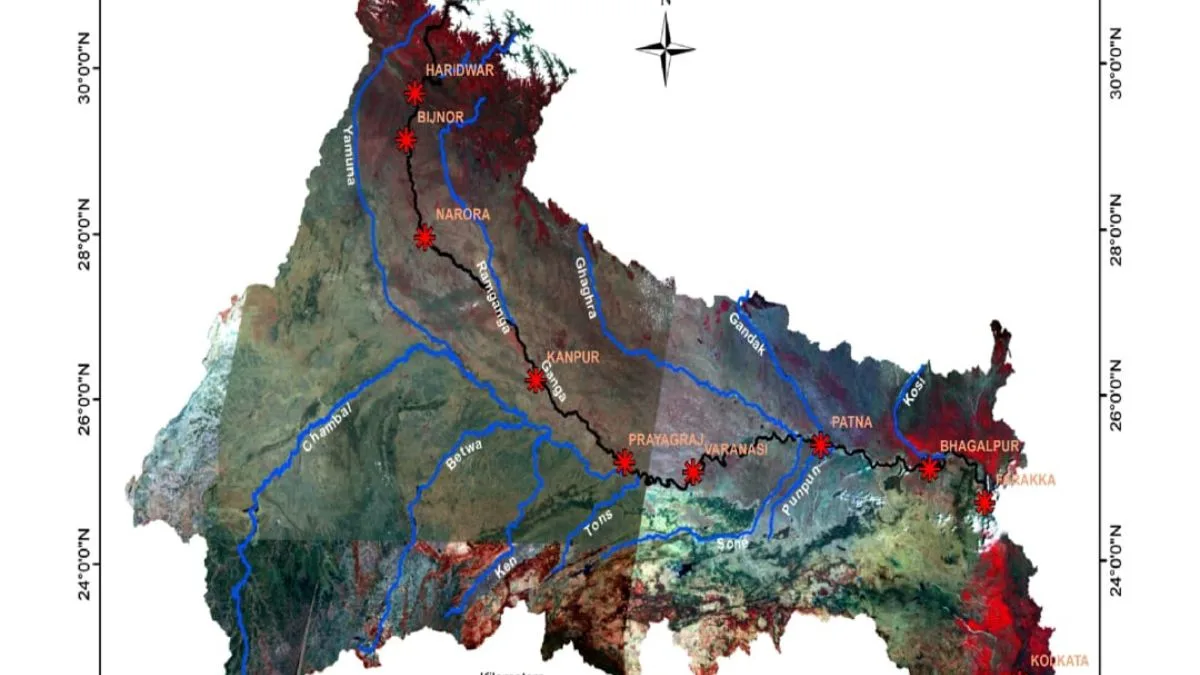
IIT-Kanpur and Namami Gange harness 5 decades of satellite data to map the Ganga’s transformation
Researchers at the institute have combined rare images captured in 1965 by the American spy satellite series Corona with advanced satellite imagery from 2018–19 to record major changes in the river’s morphology, flow, and land use over the last five decades.