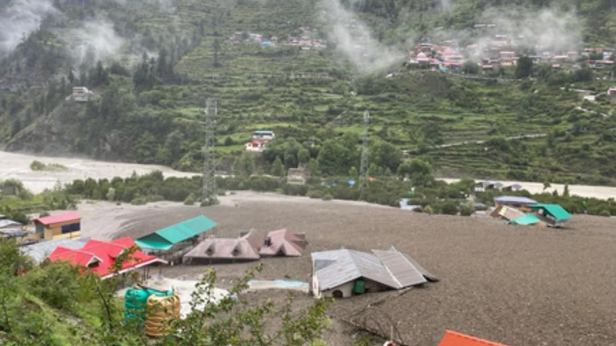
The flash floods that ravaged Dharali in Uttarkashi are a grim reminder that India’s most fragile landscapes remain dangerously under-watched. Despite decades of warning signs, the Himalayan region continues to lack the basic infrastructure needed to anticipate, let alone avert, such disasters. The fact that meteorologists cannot even conclusively identify whether a cloudburst or a glacial lake outburst triggered the destruction is not a reflection of nature’s unpredictability, it is a damning indictment of the country’s data deficit.
The confusion surrounding the cause stems from the absence of real-time weather monitoring in the upper reaches of Uttarkashi. Dharali, perched at 8,000 feet, had no local station capable of detecting or measuring the rainfall intensity that preceded the disaster. The nearest weather instruments are kilometres away, making it impossible to capture hyper-local cloud activity, especially in mountainous terrain where rainfall distribution is notoriously erratic. In regions where a kilometre can mean the difference between a dry slope and a flash flood, such gaps are more than technical ~ they are life-threatening. Each unmonitored valley is a blind spot in our national preparedness, where nature’s fury can strike without a moment’s notice.
Advertisement
Some experts have speculated that a glacial lake outburst might have occurred upstream, triggered by intense rainfall. But satellite assessments later ruled this out. The floodwaters, carrying debris, mud, and uprooted trees, appear to have been the result of localised extreme rain – perhaps not fitting the narrow definition of a “cloudburst,” but just as catastrophic in consequence. At the heart of the matter is India’s failure to scale up its early warning systems in one of the most climatevulnerable regions on the planet. Despite previous disasters and government assurances, Doppler Weather Radars (DWRs) remain few and far between in Uttarakhand. None cover the Dharali zone. While DWRs have limited efficacy in hilly terrains due to signal blockage, they are still far superior to the absence of any monitoring. Complementary tools such as Automatic Weather Stations (AWS), remote sensing, and now-casting models using microphysical cloud data could significantly bolster early detection but they have not yet been deployed at scale.
In the absence of hard infrastructure, India must also look to soft solutions: collaborations with global satellite agencies, crowd-sourced weather reporting, and even localised community alert systems that can bridge the time gap between data and disaster. It’s clear that natural terrain is no longer a sufficient excuse for technological lag. The Himalayas are both India’s environmental backbone and its most acute risk zone. As monsoon patterns grow more erratic and glacial dynamics increasingly unpredictable, waiting for disasters to validate the need for preparedness is no longer tenable. Dharali’s destruction should serve not as a tragic anomaly, but as a last warning. The next one may come sooner than we think and we may have even less time to respond.