US, Iran to hold technical-level talks in Switzerland on Sunday
The "technical-level talks" between the US and Iran will be held in Burgenstock, Switzerland on Sunday in the presence of mediators from Pakistan and Qatar.
The bulwark of the Pakistani claim for areas north of the line joining NJ 9842 with the Karakoram Pass has been that at some point of time many international cartographers had shown this region on their side.

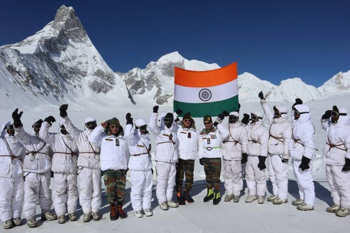
representational image (iStock photo)
Operation Meghdoot which commenced on 13 April 1984 is perhaps the costliest and longest ongoing operation of the Indian Army. It started with a brilliantly conceived, meticulously planned and precisely executed pre-emptive strike by India at altitudes where even survival is difficult, and resulted in India’s occupation of the Saltoro heights and effective control of the Siachen Glacier.
With no adjudication or settlement of the Siachen dispute between India and Pakistan, both sides have given various reasons to justify their territorial claims and much has been written about it. However, over the past few years several facts have come to light which necessitate revisiting some previously derived conclusions to appreciate the entire dispute in its correct perspective. For long Pakistan has been playing the victim card labelling India as an aggressor.
Advertisement
Understandably so, because this is far more convenient for their establishment rather than admitting that they tried, failed and were later caught napping. The fact that Pakistan indeed wanted to occupy the Siachen Glacier in March 1984 and had been planning for it before India is no longer res integra. Several Pakistani authors including Zulfikar Ali Khalid, General Pervez Musharraf and Gen Jahan Dad Khan confirm this and acknowledge that India pre-empted Pakistan in the race for the Glacier.
Advertisement
It is also an admitted position that Pakistan did occupy the Glacier in September 1983 itself with the intention of establishing a permanent base, but its troops were forced to return due to the inclement weather and lack of supplies. Thereafter it was a race for the glacier and despite Pakistan having the obvious advantage of accessibility with their roadhead being only a day’s turnround from the passes it was India which ended up occupying it. Pakistan lost fair and square. Period.
The bulwark of the Pakistani claim for areas north of the line joining NJ 9842 with the Karakoram Pass has been that at some point of time many international cartographers had shown this region on their side. However, this too has now crumbled as declassified documents reveal that the genesis of this cartographic error was the office of the US State Department Geographer Robert D Hodgson, who in 1968 unilaterally extended the ceasefire line from NJ 9842 to the Karakoram Pass, taking a cue from the US ADIZ (Air Defence Identification Zone) Maps while dealing with the question of how the boundaries of the state of J & K were to be shown in US maps.
Indeed, the line being claimed by Pakistan as its own was never even drawn by it. It was a US Agency’s tiny change to a map that pushed India and Pakistan to fight on the world’s highest battlefield when Pakistan formally laid claim to all areas on the north of Hodgson’s line, in its protest note of August 1983. It is pertinent to mention that in 1986 the US State Department removed this line from all its maps upon a query by India and no suitable explanation was given as to why it had appeared in the first place.
The veil of ambiguity, thrust upon the sole agreement which specifically deals with this area i.e the Karachi Ceasefire Agreement (Karachi CFA) of 27 July 1949, is often used to justify the presence of the now erased Hodgson’s Line, because if an agreement is vague then it is capable of multiple interpretations in contrast to something which is clear and requires none. Therefore, many authors describe the Karachi CFA, insofar as it deals with this area, as being vague. They interpret it to imply that the cease fire line ended at NJ 9842 and the area beyond it was left out as a no man’s land.
Some hold the ambiguous wording ‘thence north to the glaciers’ responsible for the dispute while others interpret the same agreement, and rightly so, to imply that the cease fire line extends beyond NJ 9842 north to the glaciers. Even thirty-eight years after Meghdoot such divergence in the interpretation of a simple document which clearly describes how the Cease Fire Line is to proceed beyond NJ 9842 is inexplicable.
The relevant Clauses of this agreement applicable to this region are Clause B2d and C of Part I which are reproduced hereinbelow: B.2(d) From Dalunang eastwards the ceasefire line will follow the general line Point15495, Ishman, Manus, Gangam, Gunderman, Point13620, Junkar(Point17628), Marmak, Natsara, Shangruth (Point 17531),Chorbat La (Point 15700), Chalunka (on the Shyok River), Khor, thence north to the glaciers. This portion of the cease fire line shall be demarcated in detail on the basis of the factual position as of 27th July 1949 by the local Commanders, assisted by the United Nations Military Observers. C.
The cease fire line described above shall be drawn on a one inch map (where available) and then be verified mutually on the ground by local commanders on each side with the assistance of the United Nations Military Observers, so as to eliminate any noman’s land. In the event that the local commanders are unable to reach agreement, the matter shall be referred to the Commission’s Military Adviser, whose decision shall be final. After this verification, the Military Advisor will issue to each High Command a map on which will be marked the definitive cease fire line.
A combined reading of Clause B2d and C shows that they contemplate a demarcation to be done in detail by the local commanders subsequent to the signing of the Agreement and therefore clearly specify how the line is to be drawn on one inch maps thereafter. Clause B2d has two distinct parts. The first part gives a directional command and the second a demarcation command. This demarcation command, whenever executed has to be executed following the directional command and not in derogation thereof. And even if it is not executed fully it does not imply that the sanctity of the intent agreed to and expressed in the directional command is diminished in any manner whatsoever.
Both clauses explicitly define the alignment of the CFL, describe exactly how it should run between both the countries and delimit it unambiguously and there is nothing vague in their formulation and language. It is quite apparent that it is the demarcation on the ground and the delineation of the line on the map which was to be done subsequently at the field level that is incomplete. NJ 9842 is the northernmost and last demarcated point on the ground en route to the glaciers, lying between Khor and the glaciers but is not the terminal point as per the agreement.
It cannot be, because the agreement clearly mentions that the cease fire line has to proceed north up to the glaciers and be drawn in a manner so as to eliminate no man’s land. So the line could not have stopped before the glaciers and be left hanging in the air thereby creating a large tract of no man’s land. If the demarcating teams could not complete the process as per the mandate of the agreement and the field commanders terminated it at NJ 9842 on account of the practical difficulties or other considerations, it does not make the intent expressed in the agreement vague or give anyone any reason to misinterpret it or sanction the creation of a no man’s land contrary to it.
The only reason why the line held by India goes slightly northwest instead of pure north is because as per established cartographic principles there cannot be straight line boundaries in mountains. Since the line cannot cut through the mountains therefore even when it moves north which it should as per the agreement it will have to follow the Saltoro Ridge crest line which is the prominent geographical feature of this area.
Another view expressed by many authors is a reference to the Line of Control (LoC) going eastwards to the glaciers in the Simla Agreement suggesting that this agreement overrules the Karachi Ceasefire Agreement in so far as this region is concerned. This is not correct as the only document which conclusively delimits and deals with the alignment of the ceasefire line beyond NJ 9842 is the Karachi Cease Fire Agreement. The LoC terminates at NJ 9842 and there is no LoC beyond NJ 9842 described in any clause of the Simla Agreement or the documents executed on 11 December 1972 at Suchetgarh pursuant to the Simla Agreement.
Siachen is often considered a low hanging fruit whenever any peace talks are envisioned between India and Pakistan. But to find a solution for any problem it is imperative to first correctly understand its genesis and identify the agreement applicable to it along with the factual matrix necessary for its interpretation. The physical demarcation of the line beyond NJ 9842 and its delineation on the map as per the mandate of the Karachi Agreement can be done even today following the principles of statutory interpretation, cartography and international law.
Once the Indian positions are acknowledged and accepted by Pakistan, then whether troops are to be maintained in the area or not and how the region is to be secured by India are issues which can be resolved easily. Pakistan’s intransigence in this matter is a tacit admission of the fact that it is aware that there is no historical, factual, legal or logical basis for its claims. That is why instead of addressing the real issues on the strength of the merits of its case it is insisting on India restoring the 1972 position on the ground. Perhaps asking for something which is not possible is the only way left for Pakistan to keep the myths of its claims and presence in Siachen alive.
(The writer is a lawyer turned entrepreneur based in Gurugram and can be reached at amitkrishankanpaul@gmail.com. He is the Author of the book ‘Meghdoot: The Beginning of the Coldest War’ which tells the story of the race to Siachen between India and Pakistan.)
Advertisement