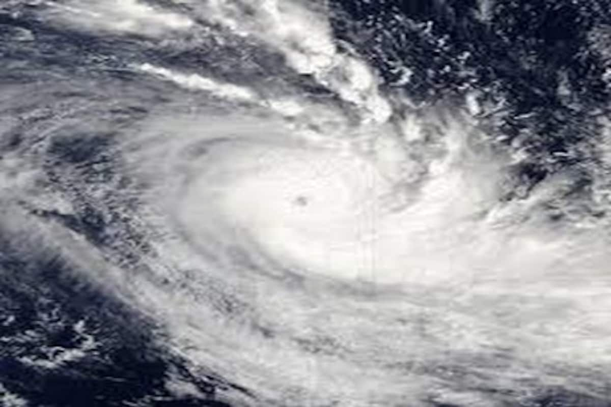
The Severe Cyclonic Storm ‘Asani’ weakened into Cyclonic Storm overnight and lay centred off Andhra Pradesh on Wednesday morning with the IMD issuing a warning for the coastal areas there.
It weakened into a Cyclonic Storm at 2.30 a.m., the India Meteorological Department (IMD) said.
Advertisement
The Cyclonic Storm Asani over the west-central Bay of Bengal moved north-northwestwards with a speed of 6 kmph through the wee hours and lay centred at 5.30 a.m. about 50 km south-southeast of Machilipatnam (Andhra Pradesh), 150 km southwest of Kakinada (Andhra Pradesh), 290 km southwest of Visakhapatnam (Andhra Pradesh), 530 km southwest of Gopalpur (Odisha) and 640 km southwest of Puri (Odisha).
“It is very likely to move nearly northwards for next few hours and recurve slowly north-northeastwards along Narsapur, Yanam, Kakinada, Tuni & Visakhapatnam coasts during noon to evening on Wednesday and emerge into the west-central Bay of Bengal off north Andhra Pradesh coasts by tonight. It is likely to weaken gradually into a depression by Thursday morning,” the IMD bulletin said.
For Wednesday, IMD has predicted light to moderate rainfall at most places with heavy to very heavy rainfall at a few places with isolated extremely heavy rainfalls likely over coastal Andhra Pradesh and heavy rainfall at isolated places likely over the south coastal Odisha.
Similarly for Thursday, light to moderate rainfall is likely to occur at many places with heavy rainfall at isolated places likely over north coastal Andhra Pradesh, coastal areas of Odisha and West Bengal.
The warning and forecast also include gale wind speed reaching 75-85 kmph gusting to 95 kmph prevailing around the system centred over the west-central Bay of Bengal, which would gradually decrease to 65-75 kmph gusting to 85 kmph by afternoon.
On Wednesday morning, squally wind speed reaching 55-65 kmph gusting to 75 kmph prevailed along and off Andhra Pradesh coast and is likely to increase and become gale wind speed reaching 70-80 kmph gusting to 90 kmph along and off Andhra Pradesh coast (Krishna, East and West Godavari, Yanam of Puducherry and Visakhapatnam districts) during forenoon to afternoon. It would then decrease gradually to 45-55 kmph gusting to 65 kmph over the region by Thursday morning.
Sea condition is likely to be high over west-central and adjoining northwest Bay of Bengal till Wednesday evening and very rough to rough over the same region thereafter till Thursday.
The IMD has also warned of a storm surge of height about 0.5 m above astronomical tide likely to inundate low lying areas of Krishna, East and West Godavari districts of Andhra Pradesh and Yanam of Puducherry.
A warning has been issued to the fishermen to suspend fishing activity entirely.