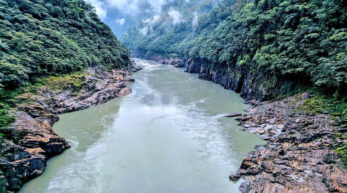
Districts along the Siang river in Arunachal Pradesh have been put on high alert for possible flash floods after China informed India about a landslide blocking a river in Tibet leading to formation of an artificial lake, officials said on Friday.
Assam Chief Minister Sarbananda Sonowal Saturday directed authorities in districts bordering Arunachal Pradesh to “remain alert” for possible flash flood.
Advertisement
Sonowal has directed the authorities in Dhemaji, Dibrugarh, Lakgimpur and Tinsukia districts to remain alert and take all possible steps to prevent any major catastrophe, a spokesman of the Chief Minister’s Office said.
Six NDRF teams from Kolkata are scheduled to arrive Guwahati and will move to the districts as and when required.
External Affairs Minister Sushma Swaraj spoke to the Chief Minister Friday night and urged him to take all possible measures in the wake of the situation.
Chinese Embassy spokesperson Counselor Ji Rong said that his country has activated the ‘Emergency Information Sharing Mechanism’ with India following the landslide on Wednesday morning near Jiala Village in Milin County in the lower ranges of Yaluzangbu river in Tibet.
The Indian official said, “They (China) first informed us on Wednesday about the landslide and creation of an artificial lake. Water is over-topping (breaching). It will reach Arunachal Pradesh and cross the high flood level by Friday night.”
The reason cited behind the landslide was “natural causes”.
The official added that districts along Siang have been put on high alert.
The water will cross “high flood mark” and the situation is being monitored at the highest level, the official added.
“The data is being shared on hourly basis,” the official said.
The Yarlung Tsangpo river is known as the Siang after it enters India at Arunachal Pradesh from the Tibetan region and is called the Brahmaputra once it reaches Assam.
Ji said the Hydrological Bureau of Tibet Autonomous Region has begun to share with the Indian side hydrological information every hour, such as the water level and flow rate at the Nuxia hydrological station and the temporary hydrological station downstream of the barrier lake.
The Chinese side will closely monitor situation of the barrier lake, and continue to notify the Indian side the follow-up developments through bilaterally agreed channels timely, he said.
The Chinese side has been keeping close communication with the Indian side on Yarlung Tsangpo river hydrological information, reflecting another positive gesture of implementing the Wuhan consensus between President Xi Jinping and Prime Minister Narendra Modi, Ji said.
In April this year, President Xi and Prime Minister Modi reached important consensus on promoting China-India all-round cooperation during the informal summit in Wuhan.
(With PTI inputs)