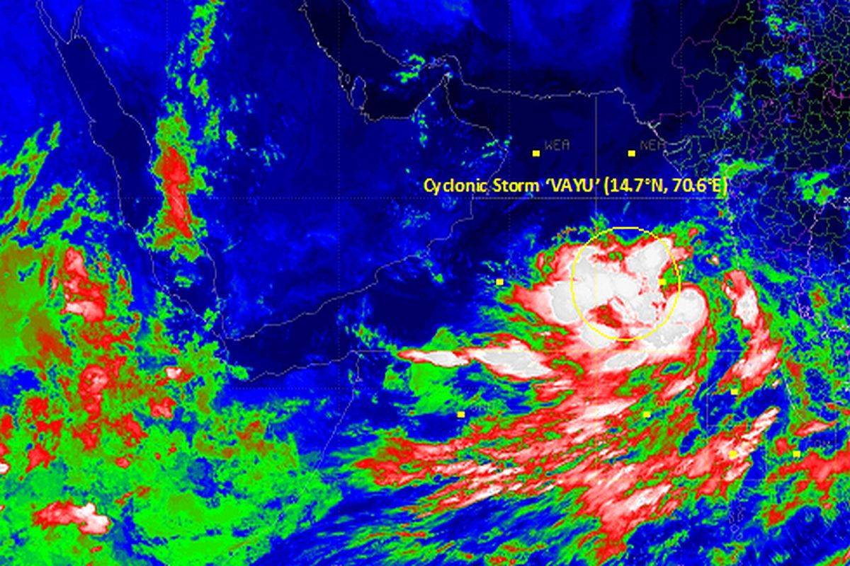
Cyclonic storm ‘Vayu’ is likely to cross the Gujarat coast between Porbandar and Mahuva around Veraval and Diu region as a Severe Cyclonic Storm with a wind speed 110-120 kmph gusting to 135 kmph during the early morning of June 13.
A deep depression which lay over south-southwest of Mumbai in the Arabian Sea had intensified into a Cyclonic storm late on Monday.
Advertisement
The weather department has put Gujarat on alert as Cyclone ‘Vayu’ is expected to bring heavy rains and winds sweeping across parts of the state at speed ranging from 75 km per hour to a maximum of 135 km.
The cyclone is expected to be closest to the Saurashtra Coast by June 12 and between June 12 and June 14, the western-most parts of Saurashtra and Kutch region in Gujarat could witness squally winds and heavy to very heavy rains, MeT officials said.
“With likely cyclonic storm even intensifying into a severe cyclone, places like Jamnagar, Somnath, Porbandar, Dwarka and Nailiya in Kutch” would be impacted, and could even herald pre-monsoons rain across Gujarat.
The cyclone might bring light showers to cities like Ahmedabad, Gandhinagar, Surat, Rajkot, Veraval and Bhuj on June 12 and June 13.
In view of heavy rainfall in parts of Gujarat, the government has deployed NDRF personnel in and around coastal areas, according to an ANI report.
A cyclone warning has also been issued in Mumbai for the fishermen and people living along the coastline.
Fishermen have been advised to not venture into the sea for the next few days and ports have been asked to flag danger signal.