Beyond Numbers
Every four years, the football World Cup reminds nations of an uncomfortable truth: population is not destiny.
Global Positioning System (GPS) is a satellite navigation system that is utilised to pinpoint the ground position of an object.

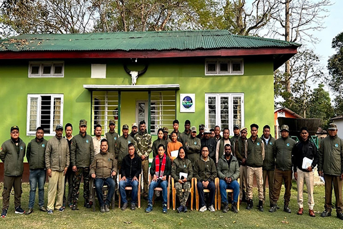
Assam, Forest to Department conducts GPS training to staff (photo:ANI)
Experts from one of India’s leading research-oriented biodiversity conservation organisations Aaranyak have imparted GPS training to the frontline forest officials from various divisions of the Assam Forest Department as part of the ongoing Elephant Estimation 2024 exercise, according to the Assam Forest Department.
Global Positioning System (GPS) is a satellite navigation system that is utilised to pinpoint the ground position of an object.
As requested by the Divisional Forest Officer (DFO) of Goalpara in Assam, Tezas Mariswamy, an expert team from Aaranyak imparted GPS training to forest officials of the division at the DFO office premises.
Advertisement
Aaranyaks senior official Arup Kumar Das imparted the training and presented block maps of the Elephant Estimation exercise to each of the forest personnel of the division as well as to the Elephant Estimation experts from Assam Forest Department, Guwahati.
“We have shown GIS-based block maps of different ranges of Goalpara Forest Division. All the Forest Range Officers of Goalpara Forest Division attended the programme.
Advertisement
Approximately, 70 forest officials attended the training. GPS hands-on training was provided to about 15 staff of the Goalpara Forest division (T) with a practical session on uploading block boundaries in GPS,” Aaranyak official Arup Das said.
Arup Das and another expert with Aaranyak Madhumita Borthakur imparted another GPS training to forest officials of the Kamrup West Forest Division of the state in response to the request made by Divisional Forest Officer Dimpi Bora.
The training was technical support for the Elephant Estimation 2024.
Apart from imparting the GPS training, the Aaranyak experts also prepared Block Maps which will be helpful for elephant population estimation.
As per an official request from N. K. Das, DFO of Tinsukia Wildlife Division to the Secretary General and CEO of Aaranyak Dr Bibhab Kumar Talukdar, the organisation’s senior official Arup Kumar Das assisted the forest division in preparing block maps and hands-on GPS training for the ongoing Elephant Estimation 2024.
The block maps of the elephant estimation 2024 for Dibru-Saikhowa National Park had been prepared for the park authority for use during elephant population estimation which has been underway since February 20 and continue till February 27.
GPS training programmes greatly enhance the ability to accurately record GPS locations of elephant sightings inside each estimation block, aiding in conservation efforts as well as habitat management., GIS-GPS expert Das said.
He along with Aaranyak official Avishek Sarkar imparted GPS hands-on training to the forest officials of the two forest ranges of Dibru-Saikhowa National Park namely, Guijan Range and Saikhowa Range.
Santana Medhi, Forest Range Officer of Guijan and Pinku Singh, Forest Range Officer of Saikhowa Forest Range were also present during the GPS training on the campus of the Guijan Range office.
In addition to GPS training, GPS Essential mobile app training has been also imparted which will be useful for fieldwork. Moreover, a practical session was organised on Uploading block boundaries in GPS using Base Camp software for elephant estimation.
Approximately, 45-50 forest officials attended the training programme.
A conservation biologist with Aaranyak, Dr Dipankar Lahkar provided training for the Elephant Population Estimation to the staff of Chirang Forest Division at the DFO office.
The objective of the elephant estimation is to guide conservation efforts by assessing populations’ health, and habitat requirements and formulating strategies for alleviating human-elephant conflicts.
Advertisement