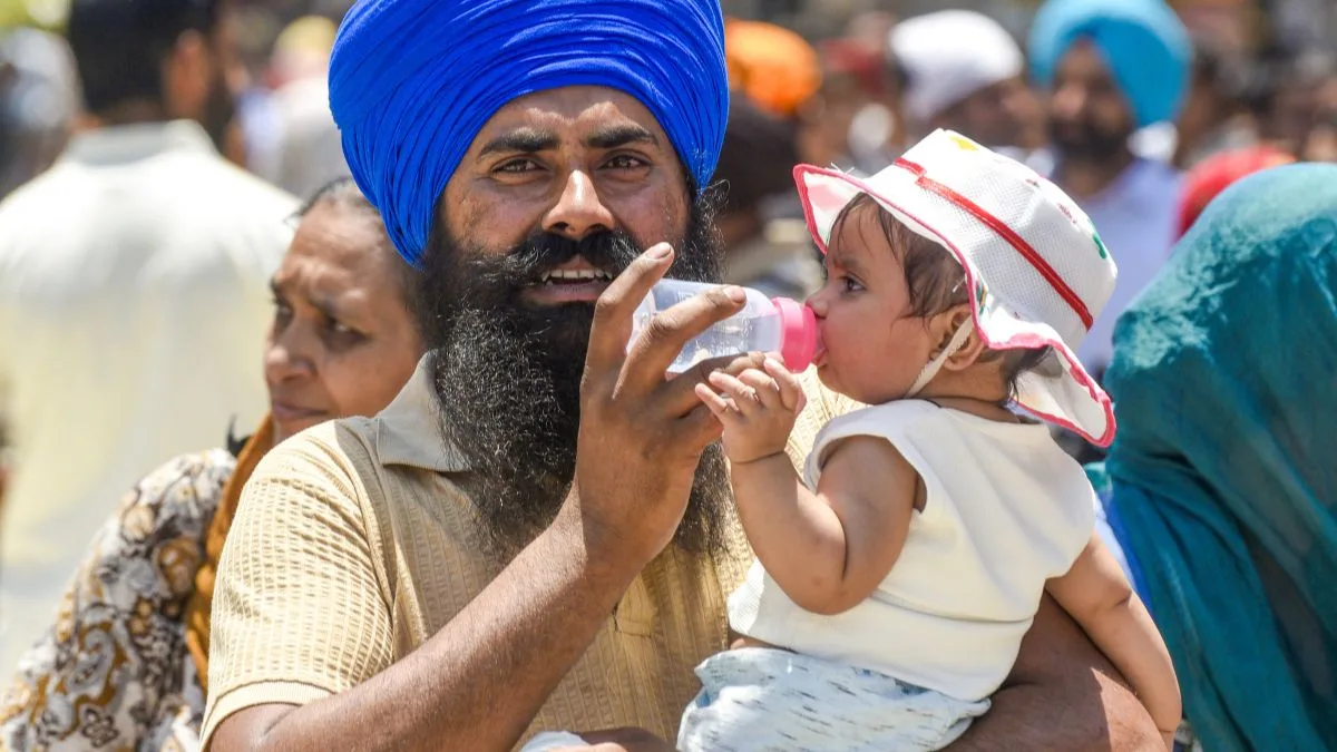
Nautapa—the traditional nine-day period of extreme summer heat in India—is still a few days away, but temperatures across the plains are already breaking records. The annual period, recorded when the Sun enters the Rohini Nakshatra, is considered the hottest period of the year. It carries astrological as well as cultural significance, including for predicting the monsoon.
This year, nautapa is falling between May 25 and June 2.
Advertisement
Even though the traditional nautapa—the nine days of extreme heat—is still a couple of days away, temperatures in the plains of the country are breaking new records.
According to the India Meteorological Department (IMD), heatwave to severe heatwave conditions are likely to continue over the plains of northwest and central India, and adjoining eastern regions in the coming week. The IMD has also forecast isolated heavy to very heavy rainfall over Sub-Himalayan West Bengal, Sikkim, and parts of northeast and adjoining east India on several days but mostly it is the back-to-back heat days in plains that are making the waves.
Maximum temperatures in recent days have ranged between 40°C and 47°C across northwest, west, central, adjoining east, and north peninsular India. Night temperatures, too, remain appreciably above normal in many areas. Meteorologists say hot and dry conditions are expected to persist, though some relief may arrive around May 29.
According to Mahesh Palawat of Skymet Weather Services, the situation is further aggravated by low humidity and hot, dry winds blowing from desert regions. “The absence of weather systems and clear, cloudless skies are allowing unobstructed solar radiation to rapidly heat the dry land surface. Winds such as the ‘loo’ from northwest India and Pakistan are bringing extremely hot, arid air that suppresses local cloud formation and rainfall,” he said.
“The lack of pre-monsoon rainfall has depleted soil moisture. When the ground is dry, the sun’s energy goes entirely into raising air temperature rather than evaporating moisture. Rapid concrete-heavy urbanisation and declining green cover are trapping heat in cities and preventing natural cooling. Some respite may come around May 29, when western disturbances or pre-monsoon showers could bring temporary relief in some areas,” Palawat said.
April and May usually witness intense heat due to increased solar radiation, dry continental winds, and the formation of low-pressure heat zones over Rajasthan and neighbouring Pakistan. However, meteorologists say the intensity and spread of the current heatwave have been amplified by both domestic and global climatic factors, turning large parts of the subcontinent into fiery shades of red, orange and deep red on IMD maps.
As it is, the IMD’s seasonal outlook this year is indicating below-normal rainfall.
The weather office has projected rainfall at 92 per cent of the Long Period Average (LPA), with a model error margin of ±5 per cent.
The LPA, based on data from 1971 to 2020, stands at 87 cm.
Meteorologists say weak La Niña-like conditions over the equatorial Pacific are gradually transitioning towards ENSO-neutral conditions. The Monsoon Mission Climate Forecast System (MMCFS) has indicated the possibility of El Niño conditions developing later in the season.
A key positive factor, however, is the neutral Indian Ocean Dipole (IOD) condition over the Indian Ocean. Climate models suggest positive IOD conditions may develop towards the latter part of the season. A positive IOD is generally considered favourable for the monsoon as it creates warmer sea surface temperatures in the western Indian Ocean, increasing moisture transport towards the Indian subcontinent and often offsetting the drying impact of El Niño conditions.
Meteorologists also noted that Northern Hemisphere snow cover during January-March 2026 was slightly below normal. Winter and spring snow cover over Eurasia and the Northern Hemisphere generally shares an inverse relationship with India’s subsequent seasonal rainfall.