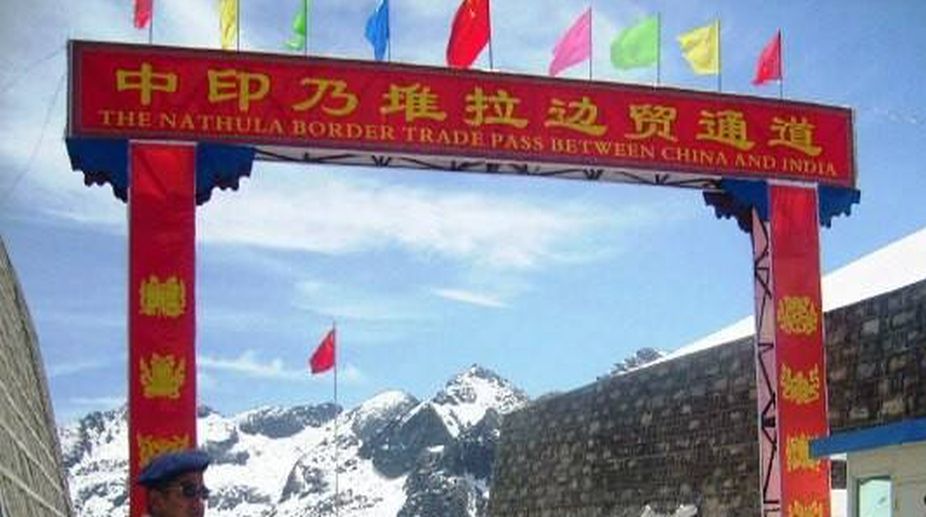
The resolution of the Doklam standoff by China and India comes as a great relief. The raging issue of connecting the Sinchella Pass to Doklam, overlooking the Bhutanese military base camp at Haa Dzong, for now, has been shelved with a diplomatic resolution between the two countries. This, of course, has to be taken forward for a permanent resolution of the border dispute.
The China-Bhutan border dispute centering on the Donglang plateau or Doklam and India’s military presence at Dong La has the potential to rake up a conflict as China asserts their sovereignty over the narrow plateau of Doklam, on which an agreement is yet to be reached between Bhutan and China.
The much-talked about 1988 agreement between India and China to not unilaterally alter the status of tri-junction points covering some 100 square kms, which China was bent on changing by constructing a road through Doklam, for now has de-escalated. This retreat of China and withdrawal of forces by India from the Chinese side of Doklam mark an end to a possible flare up, as both sides have realised their respective limits.
Indeed, Bhutan’s role in this process of mutual withdrawal is commendable, as the tiny Himalayan kingdom could really act as the broker of the deal, by not insisting that they have to maintain a strategic hold over Doklam.
What is important from India’s perspective is warding off the construction of a road that would have made Indian positions at Mt Gipmoche and army training camp at Dong La vulnerable to Chinese military offensive. Indeed China wanted to wield a strategic threat over the Siliguri corridor and beyond to keep its option of moving troops open just as it can do so at Ladakh, Chumbi valley and certain other areas.
To protect the Northeast from this kind of tactical escalation, India had to remain firm about the demand for maintenance of status quo at the tri-junction.
The memory of 1962 has been a major reason for India’s sensitive positioning on Doklam, as India has to stabilise the Northeast and make it immune from foreign aggression of any kind.
On the other hand, China’s refusal to share data of rainfall and water levels in real time with India, since the Doklam standoff broke out, amounted to making the region insecure in the face of massive floods and more than average monsoon rains this year.
Rivers flowing from Southern Tibet to the North-east and Bangladesh swelled up due to catchment rains. It has also been hotly debated whether China, by not giving India access to real time data, played a subversionist role by releasing water from its dams in Tibet that flows down the Brahmaputra and its numerous tributaries and sub-basins.
As embankments were breached and bridges collapsed, waters swelled up in the entire stretch from Sadiya-Majuli-Dhubri and marooned the whole of lower Assam. There were talks about a possible Chinese retaliation on the North-east in this way. Guarding its borders with China and Myanmar in Arunachal Pradesh by way of adequate physical infrastructure has been a priority under the India-China border roads by the Border Roads Organisation.
Indeed, conflicts related to such road-building projects are another source of competitive strategic action involving military and diplomatic stakes. India raised China’s stakes of building border roads by its enhanced projects of building road infrastructure in Ladakh and Arunachal Pradesh — two vulnerable points from the Indian perspective.
At the end of the Doklam standoff, China did not commit that it would not build the road to Doklam from the Torsa forest reserve, rather its aggressive posturing about defence patrol and protecting every inch of its territory, keeps the somewhat deescalated positions lukewarm. Before the Brazil-Russia-India-China-South Africa summit, China had to secure its global financial stakes by compromising with India on Doklam but without any formal commitment on the future.
From China’s viewpoint, the prime geo-political location of Northeast India including Sikkim and Siliguri turns it into a potential conflict zone. What is needed is bilateral and multi-lateral agreements securing shared and common natural resources and installations like port, pipeline and energy supply lines in the region. India’s North-east gets embroiled as many openings through South and South-East Asia such as the trilateral highway, gas pipeline and the Sittwe port and Kaladan Multi-Modal Project come under a cloud.
The Greater Mekong sub-regional partnership involving Thailand, Laos, Vietnam and Myanmar also has a Chinese territorial component that India has to take note of. In the Doklam stand-off, some of these crucial Indian interests were at risk as a military offensive would have substantially shrunk India’s influence on the South Asian region.
There is always a geo-political premium that India has to pay vis-à- vis China given its larger trading and security networks. If the boundary dispute could be sorted out by mutual give-and-take, it would open up the possibility of positive trade relations in the region and the Northeast could prove to be a major source of many important minerals and other resources. This calls for strengthening of the North-east’s economy. Therefore, one could argue that economic and trade interests have to take precedence over strategic and military interests.
The Himalayas need to be considered as a sovereign territory by itself, as its glaciers and flora and fauna are the major life-sustaining resources of the sub-Himalayan territories of both China and India apart from Myanmar. Further, the lower riparian rights of India and Bangladesh need to be protected as China’s ecology in the upper riparian area is dependent on the lower plains.
A basin and seismic sensitive policy of dialogue instead of mere political boundaries seems to be the unnoticed frontier between India and China. Hence, a combined economic, ecological and security policy mix can contribute to bring down any stand-off of the Doklam kind in future. Indeed, across the McMahon line, there are too many fragile points of military and security conflict that both the Asian giants need to settle.
China’s reference to colonial maps and cartography, while more advanced GPS can resolve disputes faster, only shows a dichotomised approach in the attitude of the global superpower.
India’s diplomats can intervene in a positive manner to precisely define a conflictfree cartographic imagination. Maintenance of a soft border, instead of a hard one is the need of the hour.
The continued deployment of troops has not created an enabling framework of mutual co-operation and hence, much of the talk of economic co-operation ends up in a security imbroglio. The Doklam standoff and its de-escalation should be an opportunity for overcoming conflicts by enhancing each other’s economic interests.
(The writer teaches philosophy at the North Eastern Hill University, Shillong)